GEOSCIENCE AND REMOTE SENSING
TECHNICAL PROGRAM COMMITTEE
| Chair | Co-Chair |
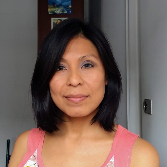
Dra. Andrea Pamela Florespflores@campus.ungs.edu.ar
Dra. Andrea Pamela Flores.She has a PhD in Science and Technology (Universidad Nacional de General Sarmiento -UNGS-), a Master’s degree in Space Applications for Early Warning and Emergency Response (Universidad Nacional de Córdoba -UNC-), and a degree in Urban Ecology (UNGS). She has extensive experience in spatial data management and has collaborated on research projects related to environmental issues. She has also worked as an advisor in the national administration (Secretariat of Environment and Sustainable Development and the Ministry of Agriculture, Livestock, and Fisheries). Her recent activities are developed in the field of Remote Sensing and Geographic Information Systems (GIS). She is an adjunct professor and researcher in the Area of Geographic Information Technologies and Spatial Analysis at the Institute of the Suburban Area of the UNGS. The project that she currently directs is oriented to the study of peri-urban environments in the main agglomerates of Buenos Aires and the process of compaction of human settlements. In teaching, she teaches courses in the University Technician in GIS, in the Specialization in Thematic Cartography Applied to Spatial Analysis, and is a collaborator of international projects whose objective is to develop educational material in geomatics with open source programs in Spanish. In research, she collaborates with multidisciplinary projects based at the UNGS and at the Universidad Nacional Arturo Jauretche (UNAJ); and she is part of the advisory team in the development of the Land Management Plan of the municipality of Mar Chiquita (Province of Buenos Aires).
Contact email: pflores@campus.ungs.edu.ar |
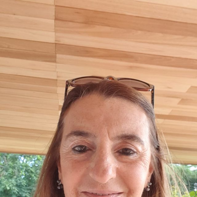
Ing. Virginia Venturinivventurini@fich.unl.edu.ar
Ing. Virginia VenturiniWater Resources Engineer. Faculty of Engineering and Water Sciences (FICH) – National University of the Litoral (UNL).
Master in Science. University of Cincinnati, Department of Civil and Environmental Engineering. Doctor in Engineering- Mention Water Resources. National University of the Coast. Associate Professor ordinary exclusive dedication, FICH-UNL. Director of the Master in Geographic Information Technology – FICH-UNL Co-Director of the Master’s Degree in Computing Applied to Science and Engineering Research: Applications of satellite information in the monitoring of terrestrial ecosystems. Balances of energy and water on the earth’s surface. Estimation of Evapotranspiration and Water Stress from satellite images. Satellite monitoring of floods with optical images and SAR. Artificial Intelligence is applied to environmental problems. She wrote 4 chapters of Books. She has more than 50 Publications in national and international congresses She participated in more than 18 research projects, of which she directed 14. She directed doctoral, postdoctoral, and master’s theses, and she is a CONICET associate researcher. She is an advisor to the company KILIMO ArgTech. |
DISTINGUISHED SPEAKERS
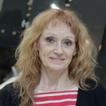
PhD. Laura FrullaLaura Frulla has a doctorate in Physical Sciences the National University of Buenos Aires. She specialized in the studies of the physical processes generated in satellite measurements and satellite instruments calibration. She has more than 30 years of experience in the area of remote sensing, image processing and information extraction. She currently works as Earth Observation Manager at the National Commission for Space Activities (CONAE) and is the Principal Investigator of the SAOCOM 1 Mission (CONAE’s SAR mission). |
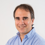
Msc. Luciano GiessoLuciano Giesso works as International Sales Director at Satellogic. He is a multinational executive with more than 25 years of experience in technology and services, of Argentine origin and with several years living in the United States for different periods. He has led teams of over 100 people in multiple countries, holding management, sales, and operations positions at various technology companies, including 14 years at IBM. Fluent in English, Spanish, French, Portuguese and German, Luciano is an Industrial Engineer from UCA and has an MBA from Universidad de San Andrés, both in Buenos Aires, Argentina. He has also completed executive programs at Harvard Business School and MIT Sloan School of Management. |
DESCRIPTION
It deals with the theory, concepts and techniques of science and engineering that are applied to the remote measurement and perception of land, remote sensing, oceans, atmosphere and space, as well as processing, interpretation and dissemination of this information.
| SUGGESTED SUBTOPICS |
| For this topic, the following subtopics are suggested. Please note that you may send your paper beyond the scope of this list. To submit the paper follow the instructions Tutorial for Paper Submissions. |
-
SCIENCE OF GEOSPACE DATA, COMPUTER VISION
- Algorithms and modeling
- Data mining in Remote Sensing
- Machine learning, big data
- Emergency management and management. Geospatial health
-
SAR DATA
- Applications
- Algorithms and processing
- Digital terrain models
- Modeling and simulation
-
REMOTE SENSING
- Oceans, coasts and inner water bodies
- Water resources
- Remote sensing in urban areas
- Agriculture, forests
- Archaeology
-
SATELLITES AND INSTRUMENTS (SENSORS)
- Geostationary Satellites EO. Orbits, instruments
- Architectures, Observation instruments
- Satellites and SAR sensors
- Applications And Products
- Application of UAV for remote sensing
- Earth observation missions
-
ENVIRONMENT CLIMATE CHANGE
- Adaptation. Prevention. Danger. Vulnerability. Risk
- Quantitative remote measurement of ODS2030 indicators
ACCEPTED ARTICLES
ID |
Title |
Author |
| 257 | Ground Surface Subsidence in Córdoba, Argentina, revealed by multitemporal SAR interferometry | Romina Solorza, Claudio Carignano, Marcela Cioccale and Claudia Notarnicola |
| 272 | A labeled dataset of cloud types using data from GOES-16 and CloudSat | Paula V. Romero Jure, Sergio Masuelli and Juan Bautista Cabral |
| 450 | Estimation of urban methane concentration from remote sensor data | Carla Stadler, Victoria Fusé, Adán M. G. Faramiñán, Paula Juliarena and Santiago Linares |
| 592 | Statistical Characterization of a Thermal Camera at Room Temperature | Danilo F. Silva Griffouliere, Maximiliano A. Burgos Paci and Clemar A. Schürrer |
| 626 | Thermal condition of Santa Fe city- Argentina during the period 2013-2022 | Virginia Venturini |
| 1278 | Evaluation of a generalized linear model for the actual evapotranspiration using satellite and reanalysis data | Adán Matías Gabriel Faramiñán, Cristian Laino, Facundo Carmona, Mauro Holzman and Raúl Rivas |
| 1615 | Exploratory analysis of urban morphology in relation to air quality in the downtown of Santa Fe City (Argentina) | Guido Delaloye and Virginia Venturini |
| 1780 | Comparison of Sentinel Products and Drone-Based Images at Two Spatial Scales for monitoring burned wetlands in the Paraná River | Virginia Venturini, Zuleica Yael Marchetti and Aylen Carrasco Milián |
| 2719 | Multi-temporal analysis of the cover change of the Serrano forest in central Argentina through remote sensing | Luna Emilce Silvetti, Gregorio Gavier-Pizarro, Julieta Rocio Arcamone and Laura Marisa Bellis |
| 2818 | Environmental characterisation of an urban area to assess the distribution Aedes aegypti monitoring system | Carla Rodriguez Gonzalez, Claudio Guzman and Veronica Andreo |
| 3622 | Advances in the algorithms for the generation of science products of the SABIA-Mar mission | Carolina Beatriz Tauro, Gastón Valvassori, Raúl Ezequiel Floreani and Facundo Eduardo Godoy |
| 4424 | Estimación del Equivalente en Agua de Nieve en base a técnicas de Interferometría Diferencial y datos de la constelación SAOCOM | Sofia Andrea Teverovsky Korsic, Romina Solorza, Alvaro Soldano and Claudia Notarnicola |
| 4445 | Detección de agua en superficie en el río Negro con índices espectrales y análisis del impacto sobre el acuífero freático | Ayelen Montenegro, Mauro Holzman, Dario Fernandez, Lucia Mañueco and Maira Guiñazu |
| 5129 | A ship detection model for SAR data based on Yolov4: application to images from SAOCOM and SENTINEL | Joaquin M. Bozzalla, Juan J. Silva, Jorge L. Marquez and Leticia M. Seijas |
| 5363 | Mapping the potential soil CH4 diffusion coefficient for Buenos Aires (Argentina) | María De Bernardi, Jorge Francisco Diez and Gabriel Gatica |
| 5381 | Aplicaciones de datos SAR y procesamiento en la nube para el estudio de incendios en el Bosque Chaqueño Serrano | Cynthia G. Garay, Pons Diego, Juan Doblas Prieto and Cavallero |
| 5779 | Community Food Environments, exploring a geomatic vision of regional scale | Micaela Natalia Campero, María Victoria Marinelli, Carlos Matías Scavuzzo and María Dolores Román |
| 6255 | Flooding dynamics of a basin in the Santa Fe plains | Edna Lucía Espinosa Gómez, Leticia Rodríguez and Carlos Scioli |
| 6720 | Study of the impacts of Land Use-Land Cover on surface water quality based on field data and satellite information | Sofía Paná, Anabella Ferral, María Victoria Marinelli, Irene Petrosillo, Inés del Valle Asís, Mariana Roqué and Matías Bonansea |
| 7209 | Determinación de hidrocarburos aromáticos policíclicos retenidos en partículas atmosféricas en la provincia de San Juan, Argentina | Mariela Lucia Aguilera Sammaritano, Almendra Brasca Merlin, Daniel Alfredo Bustos, Maria Julieta Salazar and Eduardo Wannaz |
| 7976 | First results of PRISMA satellite data applied to water quality monitoring in Argentina | Víctor Gauto, Anabella Ferral, Matías Bonansea, Farías Alejandro, Marcelo Scavuzzo, Osvaldo Cardozo, Alba Germán and Claudia Giardino |
| 8147 | Biomass estimation of Sporobolus spartinus with Multispectral Images from a Fixed-Wing Unmanned Aerial Vehicle and a Spectrometer | Néstor Di Leo, Emiliano Jozami, Enrique Montero Bulacio, Nicolás Rigalli, Martín Romagnoli, Ivana Barbona, Margarita Portapila and Susana Feldman |
| 8426 | El Tiempo de Coherencia en las Señales GNSS-R y sus Consecuencias | Santiago Ozafrain and Pedro Agustín Roncagliolo |
| 8583 | Uso de imagenes multiespectrales y termográficas para caracterizar el estado de un viñedo | Flavio Capraro, Daniela Pacheco, Beatriz Pugliese, Fernanda Gimenez and Silvina Infante |
| 8589 | Remote glacier monitoring network in Antarctic Peninsula | Hernan Rodriguez and Sebastian Marinsek |
| 9687 | Evaluación de la coherencia interferométrica sobre plantaciones forestales en Argentina con SAOCOM-1 | Santiago Ariel Seppi, Carlos López Martinez and Marisa Jacqueline Joseau |

